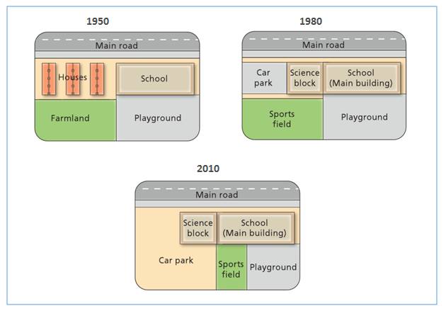
The map illustrates the alterations that have occurred in west side of Junior High School during six decades period beginning in 1950 and ending in 2010. The most noticeable change was the replacement of green areas with car park projects. The residential also altered on the west side of school, where large car park stood out in place of the house.
To begin, from 1950 to 1980 there were several changes in the school's facility. Science block had been built next to school as the main building and it replaced the residential. In addition to this, car park was constructed beside science block. Also sports field was placed behind science block and car park which it used to a farmland.
Between 1980 and 2010, car park had been enlarged and it replaced the place of sports field. While sports field was moved to south side of the school, it took almost half of playground area.

MAP1.jpg
