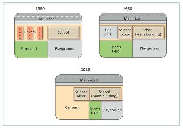
The map illustrates the transformations that have occurred in the West Park Secondary over 60-year period. The most noticeable changes were the replacement of residential and farmland area with establishment of Car park. However, the development of Car park was larger year-by-year.
To begin, there were several major alteration of the West Park between 1950 and 1980. In 1980, the housing which was opposite the main road had been replaced by car park and science block while there was farmland in the south west Park secondary which had been eliminated by sport field located beside playground.
Turning to 2010, the area of old sport field was relocated to a smaller new one, which took one in three part of playground. Nonetheless, the field of car park was threefold greater than the previous year, and main building of school remained stable over the following year.
Interestingly, although there were tremendous changes happened in the Park, the main road and the school remained unchanged.

Changes_place_at_wes.jpg
