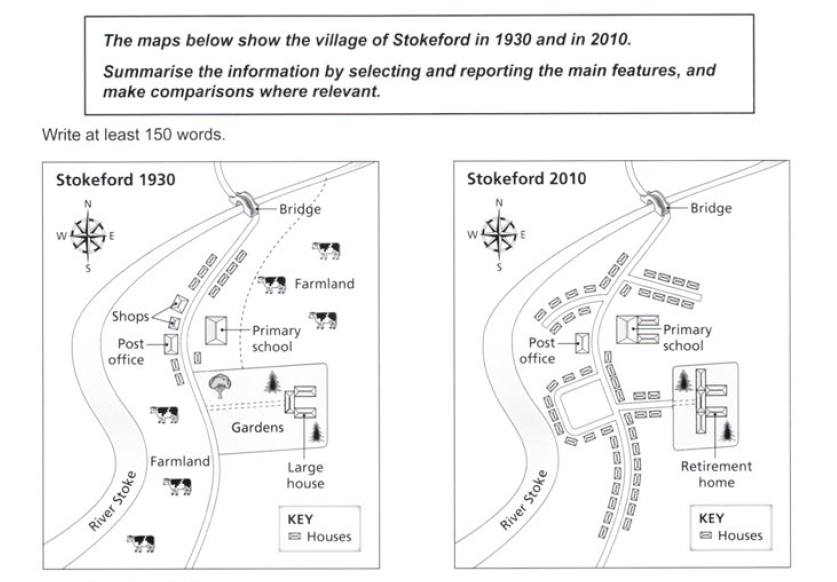
The maps illustrate the changes on the village of Stokeford over 8 decades beginning in 1930. Overall, it is obvious that there was a functional shift of green large farmland and green area over the period. Meanwhile, the number of villagers' accommodations increased remarkably.
Turning to the agricultural land where people also grew livestock, the north east and the south west area of Stokeford were originally farming land in 1930, but in 2010, half of those area shifted to be residences albeit the rest is just unspoiled land. In addition, a primary school in north east which was small 80 years ago was constructed to become bigger.
The massive rise of population also destructed two shops, stood up in 1930, just beside the post office so that housing and a short new road could be built there. The gardens had totally changed into retirement home whilst road and accommodations constructed immensely there as well as in others part of Stokeford.

19.jpg
