ainirere /
Apr 10, 2016 #1
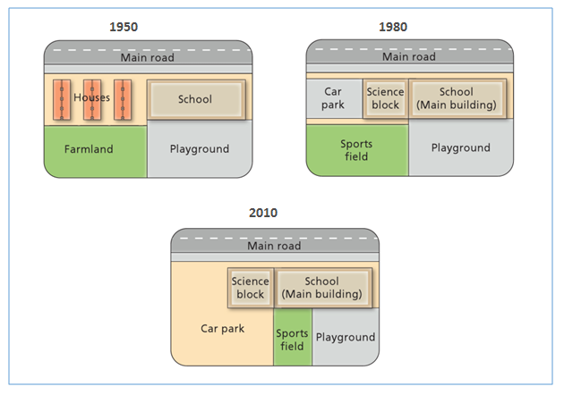
The diagrams below show the changes that have taken place at West Park Secondary School since its construction in 1950.
The diagrams illustrate the changes at West Park Secondary School in 1950, 1980 and 2010. It is noticeable that many buildings have been repaired over the year.
In 1950, the area of houses was built next to the school where these buildings were near a main road that located in front of them. Furthermore, a large of farmland was placed behind the houses, while the area behind the school was a playground for children.
However in 1980, the houses area was changed to be a science block with the car park next to it. Moreover, the farmland shifted function to be a large sport filed, whereas the playground still existed.
Then in 2010, the car park was larger than before due to the sport field beside the science block was moved to beside the playground. Thus, the playground was no longer larger out of half its area was used for sport field.

Academic_IELTS_Writi.png
