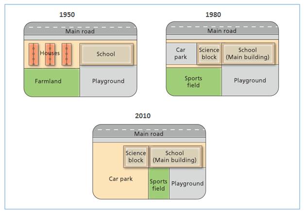
The maps illustrate the differences which had occurred in a particular area every 3 decades over a 60-year period. The most noticeable change is the functional shift of housing and farming area to being public facilities, particularly educational institution.
To begin, there were only a school and a playground constructed in the west area of the map, along the main road, in 1950, whilst a half of this land occupied by three residential buildings and a large green farmland. The construction in 1980 had altered the east area to being the part of the school edifice where the previous citizen accommodations became car park and science block. The farm land slightly enlarged for being sports field where the students sport activities taken place.
In 2010, the whole area has exceptionally become public facility as the school zone was greatly built. However, while the size of car park was widened, in contrary, the range of sport fields was cut as well as the playground.

17.jpg
