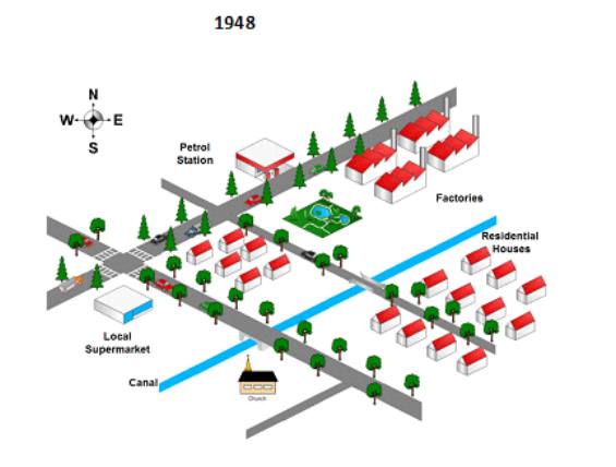
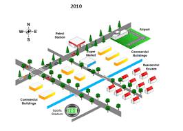
The maps reveal the information about the alteration land in the city of the United States in the course of sixty two-year started in 1948. Overall, it was essential to bear in mind that residence and local market were changed into factory located in the northwest of the canal, while the church transform into the stadium in the southeast of the river.
As we can see in the southwest of the river, there was no alteration regarding the residential house. Interestingly, stadium took over the church's position particularly located in the south of the canal.
Turning to the northwest of the river, the six settlements were reconstructed by two commercial buildings. Meanwhile, the industrial areas are demolished and replaced with two regions such as airport and also three commercial areas. Although the supermarket covered with the apartment, this facility had been relocated in front of the petrol station.

map_2b.jpg
map_2a.jpg
