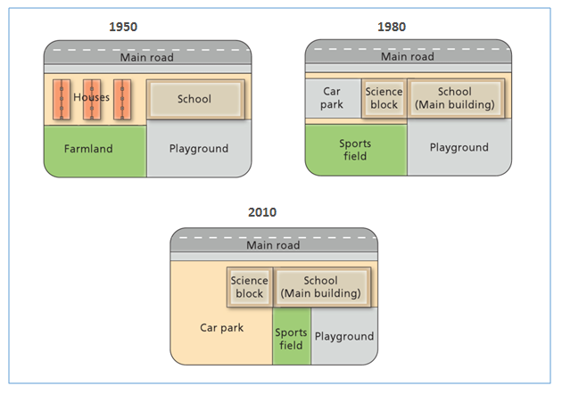
The changes that have occurred in selected area, around school area, there were two periods of continuous development, each period of 30 years, starting from 1950, then 1980 and 2010 is demonstrated in the map. Overall, it can be seen, the most noticeable change was the replacement of houses and farmland with several projects then these change with other projects in the next period.
To begin, there were several major changes to the left of schools building and playground area in first development period, from 1950 to 1980. Three Houses had been changed with car park and science block beside the school in first period. Farmland witnessed a change in use to be sport field. However, school building and playground saw a similar condition over the 30 years.
Turning into the second period, the next 30 years, in 2010. Car park located to the left of science block extended the area. Sports field located on just south from car park was used as the expansion of car park. And the playground was minimized, then a part of which was used as sports field with size less than before.

map_for_ielts.png
