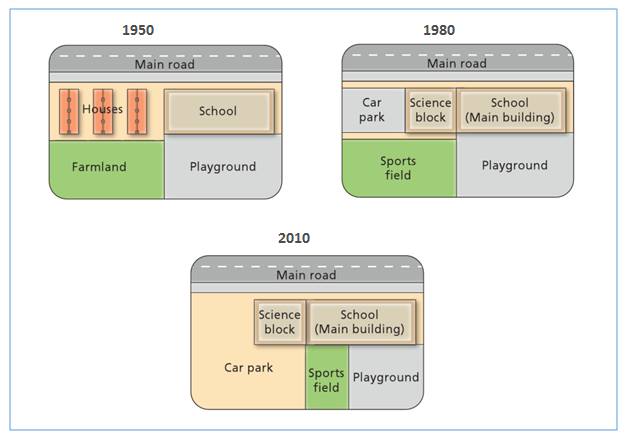
The diagrams show the changes that have taken place at West Park Secondary School since its construction in 1950
The maps illustrate the changes which have occurred in West Park Secondary School, over 6-decade period beginning in 1950 and ending in 2010. A significant change is the replacement farmland and houses with car park and science block over 60 years. However, there was remained unchanged in the school and the main road.
To begin, the most noticeable change was shown when the farmland in 1950 was constructed with a sports field in 1980 and a car park in 2010. Moreover, 1950 saw a several houses. It was redesigned to be a car pak and science block in 1980 and 2010.
Furthermore, the playground experienced a slight change over the years, because the only difference was extensive of its area. There was a quite small sports field next to the play ground in 2010, while in 1950 there was no sports field. Interestingly, the main road and the school stayed unchanged over 60-year period.

12096165_12449415322.jpg
