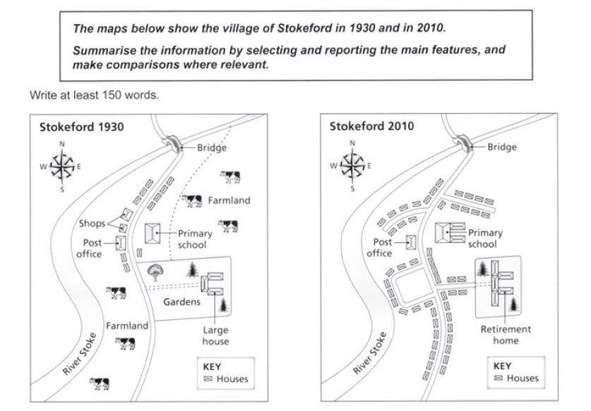
The maps reveal about the transformation have occurred in the countryside of Stokeford over an 80-year period. It is noticeable that the most significant changes were the farmland area which had been removed, while the establishment of residential was larger year-by-year.
In the north area, there were the shops beside housing area and post office in 1930, which had been replacement by the most remarkable of residential development. Next, the primary school was opposite the shops had became enlarger, which had two buildings in 2010. In addition, the farmland area to supply the livestock had been eliminated because of the increasing of infrastructure. However, bridge remained unchanged.
In 2010, in the middle of village, there was a garden in which a half of area had been taken over housing, and also larger house had been relocated on retirement home. There was a dominant alteration next to river stoke. In the south, the emergence of the tremendous and enormous housing looked at alongside behind the river.

The_village_of_Stoke.jpg
