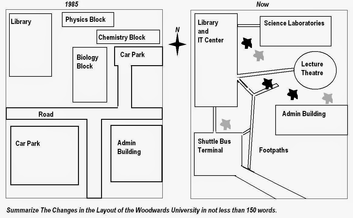
The Woodwards University's map portrays the changes from 1985 until now. The most significant change is the demolition of many buildings over 20 years. It can be seen the transformation of some buildings with open-space.
First of all, the Woodwards University replaced the largest car park with a shuttle bus terminal and there had no car park anymore.The small car park reformed the lecture theatre between the science libraries and admin building. In addition to this, it switched from the road in 1980 to the shuttle bus line which connected to all buildings except the farthest, science laboratories and passes by admin building.
There have also combined some buildings. Physics block, chemistry block and biology block in the north east became science laboratories behind the lecture theatre. A library which had been opposite the biggest car park in the past was extended and joined with the IT center which now was in front of the shuttle bus terminal.
Finally, admin building which has large building in 1980 has also altered to be long building in the east. Moreover, the remnants of space was built open-space, such as footpaths.

Graph_6.JPG
