The diagrams below show the site of a school in 2004 and the plan for changes to the school site in 2024
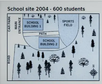
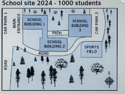
The maps illustrate some changes to the site of a school over a period of 20 years (2004-2024)
Overall, the school site is expected to experience considerable changes during the period shown. The most noticeable differences between the two maps are the expansion of roads to car parks and the reduction of a sports field.
As can be seen from the maps, the school is likely to witness an increase in the total number of students from 600 students in 2004 to 1000 students in 2024. Therefore, the school site would need more school buildings to create enough rooms for every student. School building 1 will merge with school building 2 and a new school building will be built on the original site of a sports field.
Turning to other school facilities, we can see that a path from the entrance to the sports field will be narrowed by half and lead to school building 3 instead. A new road will be constructed in the middle of the school site and head to a new second car park in the northeastern school site. The sports field will be relocated to the west of the school site next to car park 2 and narrowed significantly.

2004
2024
