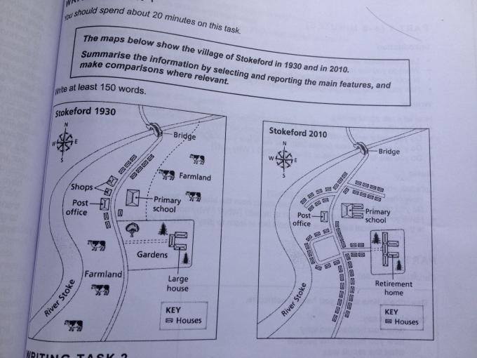
The map reveals the information about the improvement in Stokeford area by two periods. Overall, there was significant alteration with some facilities that had been built in this city.
Looking to the south area first, by 1930, there were many farmlands near by river Stoke and there was a big settlement with large gardens. It also could be seen that there were motor way which connected from south to the north part. However in 2010, the farmland had been replaced with the construction of accommodations which showed a significant improvement. Surprisingly, a large garden had been renovated by several houses and street.
Turning to the north area, by 1930, the post office and shop centers had been built in this village. It was also followed by primary school and several occupy which located in northern of the city. Surprisingly, in 2010, the shops did not exist anymore and replaced with residential area whereas post office remained unchanged. The elementary school was redeveloped to modernized building and several houses were developed as well.

Map_graph_1_Bulan_K.jpg
