Woodward University Map
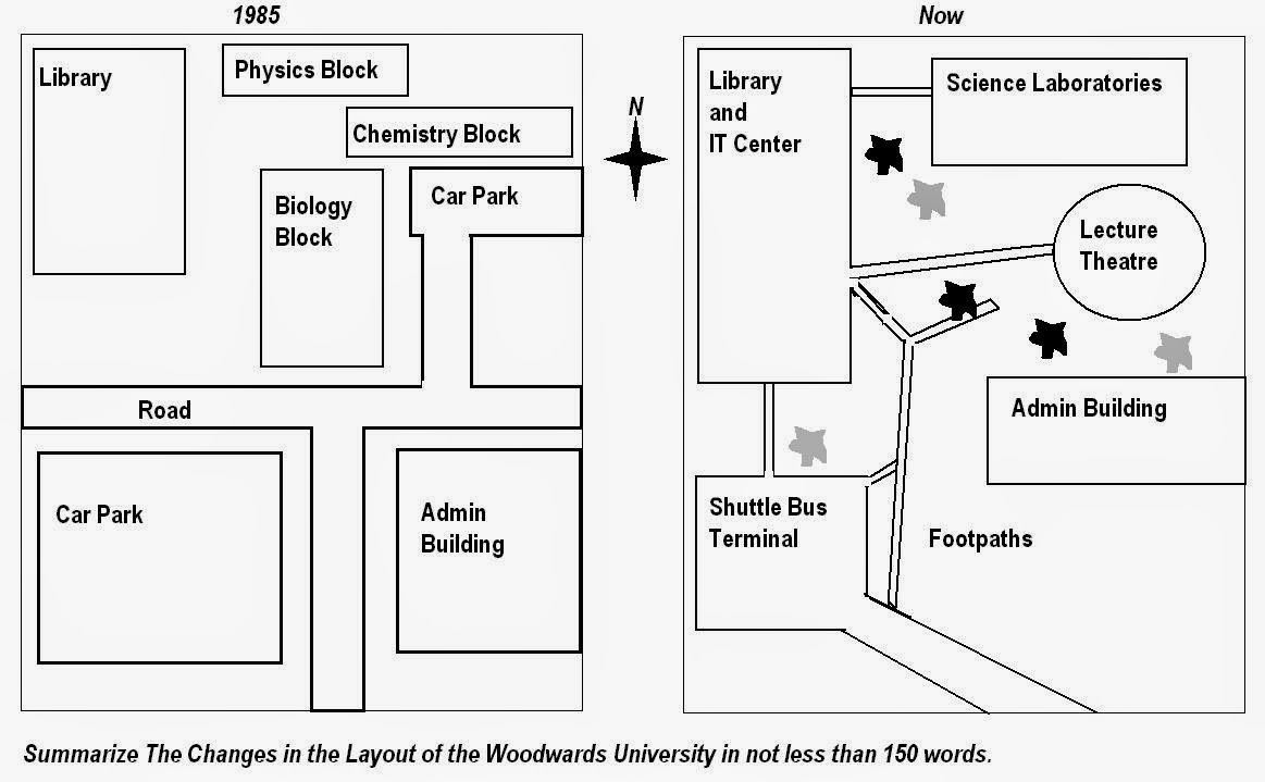
The given maps illustrates how campus of Woodwards University changed from 1985 to today.
Over the time period, the settlement underwent considerable changes.Main road was removed completely, whereas new facilities were added and constructed.
Car park to the south of the library was demolished and replaced with shuttle bus terminal.Road that connected to utilities such as admin building, biology and chemistry blocks was knocked down and more branched footpaths were developed.Apart from a road in 1985, there was not any footpaths that establish a conection among buildings but as of today foothpath are available and connects buildings inside the campus.Also, a new IT center were introduced inside the Lİbrary Building and border of Library building was expanded.
Additionally, life science departments and car park to the east of library totally were demolished, instead lecture theatre and science laboratories were built.Finally, Admin build where located to the southeast of library in 1985 was relocated to the south of lecture theater today.
Please rate my writing and any positive and negative feedbacks are appreciated.Thank you!

260340_1_o.jpg
