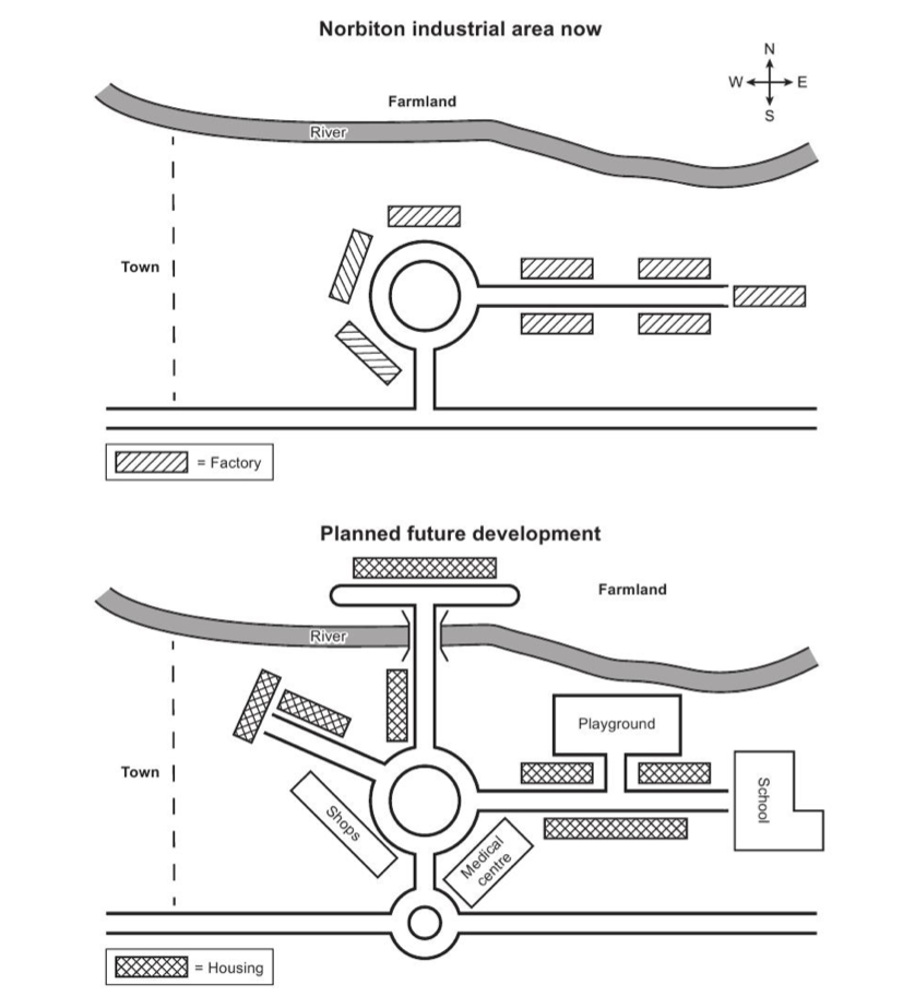
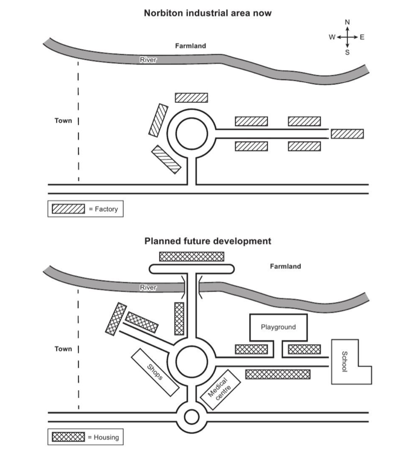
The maps below show an industrial area in the town of Norbiton, and planned future development of the site.
The maps aim to illustrate an industrial area in the town of Noriton and the future changes that is going to take place to develop the site.
As can be clearly seen from the two graphs, more roads and a small roundabout will be built connecting to the currant roundabout. Also, the industrial area will be replaced with residential area and recreational area.
One of the most visible changes is new roads are going to be erected. Considering the street that has been located in the east of the town, a T- shaped road will be built connecting the farmland across the river. A small road is being considered to be placed in the north west of the roundabout. Looking in the south of the town, another roundabout is going to be built connecting with the main one.
Another noticeable alteration is the transformation of the industrial area. Factories along the street will be converted to houses. In addition to the new streets, new residential area is going to be built along those. The farmland will be relocated to the east of the town and new facilities such as school, playground, medical centre and shops will be places between the houses and roads.

MAPS
MAPS
