islip town map and development plan
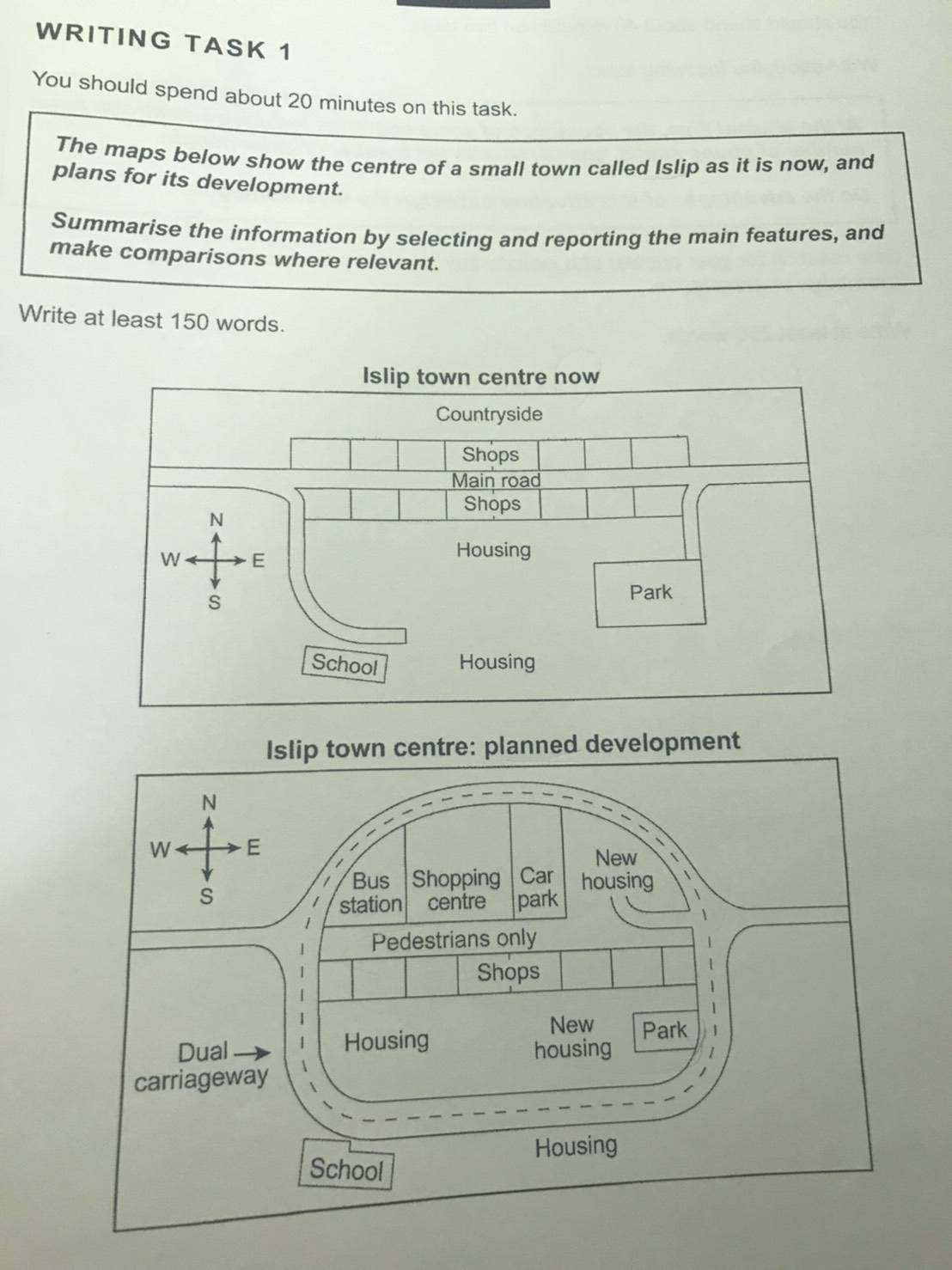
The diagrams illustrate the current construction of the town called Islip and the scheme which will indicate following a planned expansion.
Overall, some shops and the countryside are set to become different kinds of facilities, and the transportation of the town is planned to encircle most construction.
At present, the broad countryside in the north of the town, to the south of which are two rows of shops which flank the main road. Following, a wide residential area is placed in the south of the shops, to the west and east of which is positioned a school and a park respectively. Whereas both of them could be reached through branches of the main road extended in the east and west.
In the development scheme, the countryside and the northern side shops will have been replaced by a bus station, a shopping center, a car park, and new housing from west to east of the town. While the main road will have been turned into a pavement, which will have been connected to the dual carriageway through a branch. The circular way will have encircled most infrastructure except the school and the residential area in the southwest and south of the town respectively. Finally, the park will have decreased in size, to the west of which is new housing.

S__106741763.jpg
