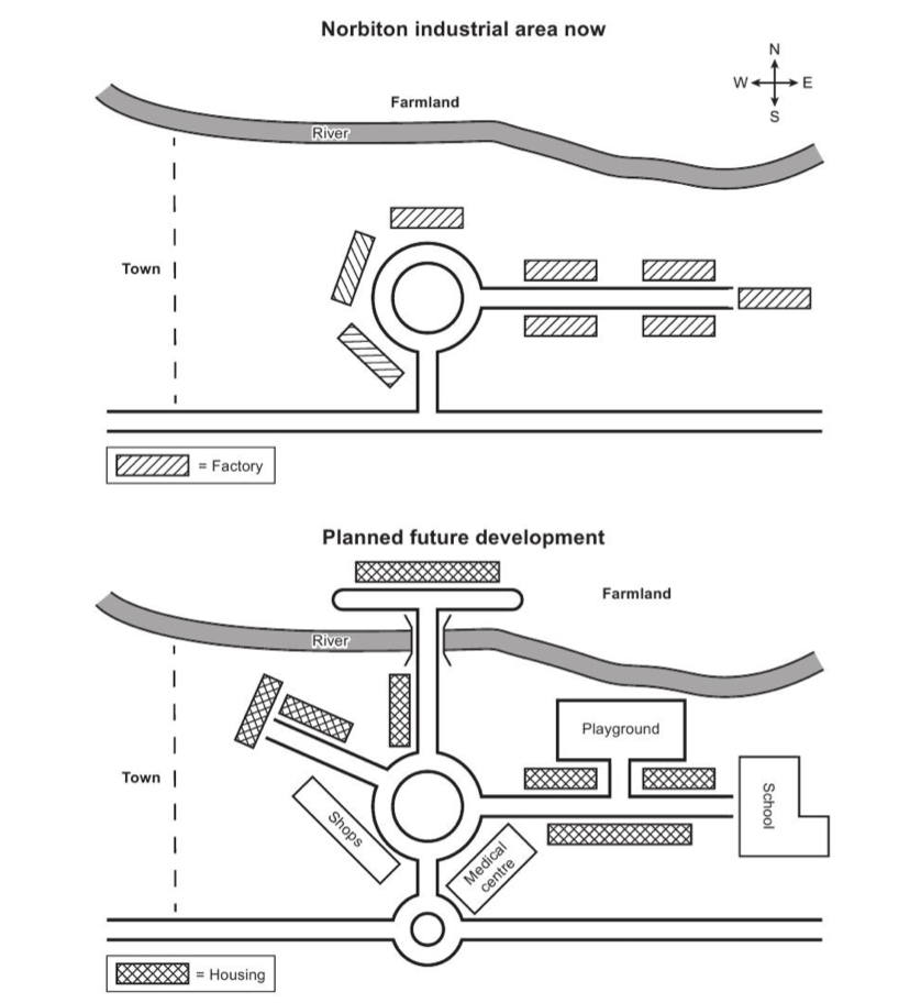
industrial area map in the town of Norbiton
The maps depict an industrial place in Norbiton town at the present and the future itself.
Looking at the maps, there will be a lot of changes in the future development of the area. The extension in paths and the replacement of factory.
A path will be formed to the north of the roundabout and cut through the river above the map. Moreover, housing will be built at the end of the the path. A playground together with a school, according to the plan, are going to be located near the river and to the East of the center of the map. A medical centre is going to be constructed below and to the South-East of the roundabout.
Following the changes, a shop with a path are built to the West of the circle. A small roundabout will also appear below the bigger one in the future days. Last but not least, the replacing all factory into housing area is the most noticeable in the maps.

ScreenShot202206.png
