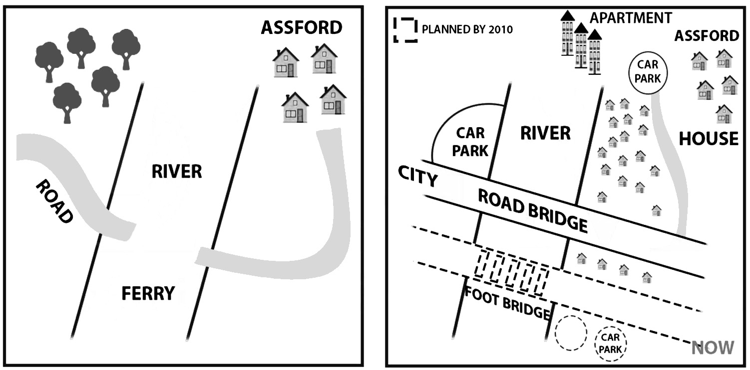
The two maps illustrate an area before and after some refurbishments from 2005 to now.
As can be seen from the plans, the most notable change taking place in the area is the construction of a road bridge, which replaces the ferry.
In 1965, the ferry was constructed to help people crossing the river. Connected with the ferry are two paths, one leads to the big road and the other one to the house area.
In the present day, the layout of the place has been revised. The ferry is now replaced by the road bridge which has the same direct way into the city. Moreover, on the north side of the road bridge, there is a big car park on the left of the river, while on the right side of it is a pretty dense housing area with 3 apartments located behind it. Also, a smaller car park is newly built, which can be accessed via a minor road connecting with the road bridge.
Finally, in the south, besides a few houses that have appeared, there is a footbridge for pedestrians only, another car park and a yacht marina all expected to be opened in 2018.

IETLSWritingrecent.jpg
