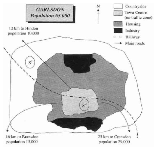
A breakdown of two potential locations S1 and S2 for a new supermarket in a town called Garlsdon is illustrated in the map. Overall, it is important to note that the main difference between the two sites is that S1 is outside the town, whereas S2 is in the town centre. In any case, the railway which goes across the whole town and the main road linking the town centre with Hindon.
A more detailed look at to the map reveals that the first potential location (S1) is outside the town itself, and is sited just off the main road to the town of Hindon, lying 12 kms to the north-west. This would make it accessible to shoppers from both Hindon and Garsdon who could travel by car. S1 also close to the railway line linking the two towns to Gransdon (25 km to the south-west), a potentially large number of shoppers would also be able to travel by train.
In contrast, S2's location is right because it takes place in the town centre, which would be good for local residents. Theoretically the store could be accessed by road or rail from the surrounding towns, including Brandson, but as the central area is a no-traffic zone, cars would be unable to park and access would be difficult.

mappp.png
