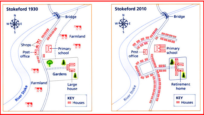
The maps below show the village of Stokeford in 1930 and in 2010.
The maps illustrate the changes which have occurred in Stokeford village from1930 to 2010. The most noticeable change was the replacement of many green areas with several houses. However, there was a slight difference in the change of its area, particularly on the size of the region.
To begin, 2010 experienced a significant difference in the development, particularly the loss of the farmland in several areas. Furthermore, in 1930, farmland located in North East of Stakeford had redesigned with the complex of houses. This situation was same with farmland next to River Stoke, farmland had changed to housing area. In addition to this, the gardens and the shops had also altered with a wide range of houses.
Furthermore, there were some buildings which have slight change between 1930 and 2010. This difference had occurred in the extension of its territory, like primary school and large house. As such, in 2010, the school and retirement home had become larger than in 1930.

271713_1_o.jpg
