The colorful propaganda maps in 20 century wars
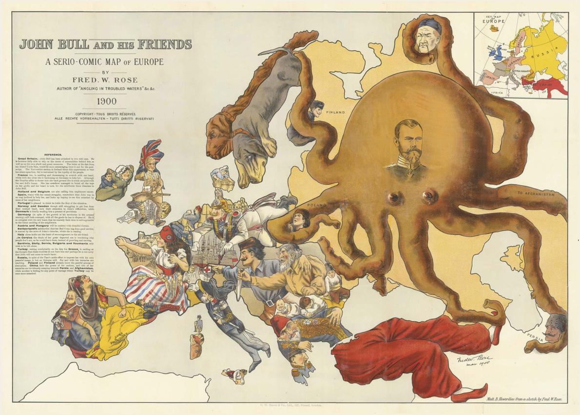
Maps made to persuade to the public during war times were funy, attractive and informative. This is occurance during 20 century, every maps has hidden agenda, it is clear to convince to the public that war is must have and they has common enemies. For the example, war map of Rusia created in 1900 by Frederick Rose, British cartographer, this map reveal detils about politics, art and cultur of the countries. The main actor of this map revealed by big octopus with big body and long tentacles reaching out in all directions, strangling Poland, Finland, and China, and reaching toward Turkey, Afghanistan, and Persia. As the result, most european are depicted as victim of Rusia colonialism. In addition, war map can be seen international situation in one picture, and make fast the spread of information in the world. Pople will easy to understand the information but several persons it called propaganda.
Maps made to persuade to the public during war times were funy, attractive and informative. This is occurance during 20 century, every maps has hidden agenda, it is clear to convince to the public that war is must have and they has common enemies. For the example, war map of Rusia created in 1900 by Frederick Rose, British cartographer, this map reveal detils about politics, art and cultur of the countries. The main actor of this map revealed by big octopus with big body and long tentacles reaching out in all directions, strangling Poland, Finland, and China, and reaching toward Turkey, Afghanistan, and Persia. As the result, most european are depicted as victim of Rusia colonialism. In addition, war map can be seen international situation in one picture, and make fast the spread of information in the world. Pople will easy to understand the information but several persons it called propaganda.

02_war_map_rose.adap.jpg
