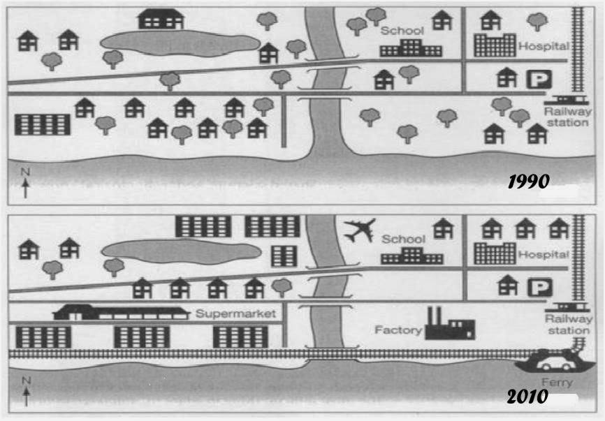
The two maps display about an area before and after the development in Bradenburg over twenty year period. Overall, there are significant change with the several facilities that had been built in the town.
In the center of town, after the construction, the railway station was constructed to across the sea between left and right area. Moving to the eastern side, the facilities such as big building was developed bigger than before that close to the bridge. Also, the tree was cutting-down and witnessed drop the number. In south-east, the interesting side come from the supermarket replaced many houses. However, the house experienced decrease number by four.
Turning to the western side, the airport was built near to the school. On the right side, it can be seen that there is a massive development in settlement sector with the improvement by two houses. In addition, in the bottom side, the factory and the port were constructed in close to the railway station.

map_2.jpg
