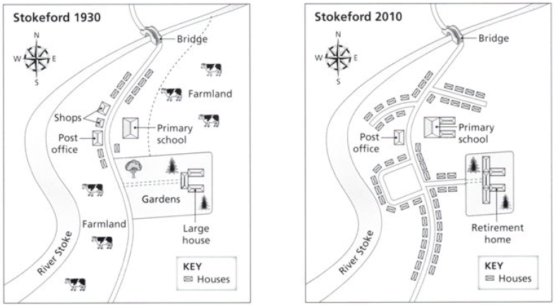
The map illustrates the main changes that have occurred in the village of Stokerford between 1930 and 2010, over a 70-year period. The most noticeable change is the replace of cattle farmlands with several major of residential zones.
According to the map in 1930, the housing areas only located in the middle of the village which were 10 houses. However, in 2010, there were urbanized with many houses along the main road. Moreover, the area of large house and garden was situated near by primary school in 1930 while in 2010, that area was modernized as the Retirement home.
A closer look at the picture shows that shops which were located in the beside of post office, in 2010, had been replaced by houses although post office as the public facility had stood at the same position. Meanwhile, primary school was extended with two new buildings in the east of the main building. Interestingly, the main road which was running from the north to the south of village in 1930. 2010 were built some branches of roads which connected to housing areas and retirement house.

map.png
