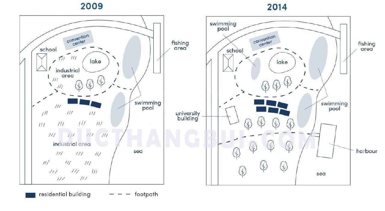
development at the waterfront area of a Darwin town
The given map illustrates the development at the waterfront area of a Darwin town between 2009 and 2014.
Overall, the town showed the complete obiliteration of the industrial area to make this place for more rensidential and cleaner. Additionally, the town's infrastructure had been renovated by added a harbor and more footpaths.
In details, in 2009, the vast greenland which was place in the south of the residential building was used for the industrial. However, the industrial were non-existent because of the replacement of trees in 2014. In addition, an university building was built at the west of the town and some residential building appeared in 2014. To the southeast of the town there was an appearance of the harbor and some new footpaths which acrossed through the town.
To the center of the town, the area encircled by footpath was replaced by the swimming pool, while the lake, convention center and the school remain unchanged. The two swimming pool by the beach and the fishing area are still permanent from 2009 to 2014.

....
