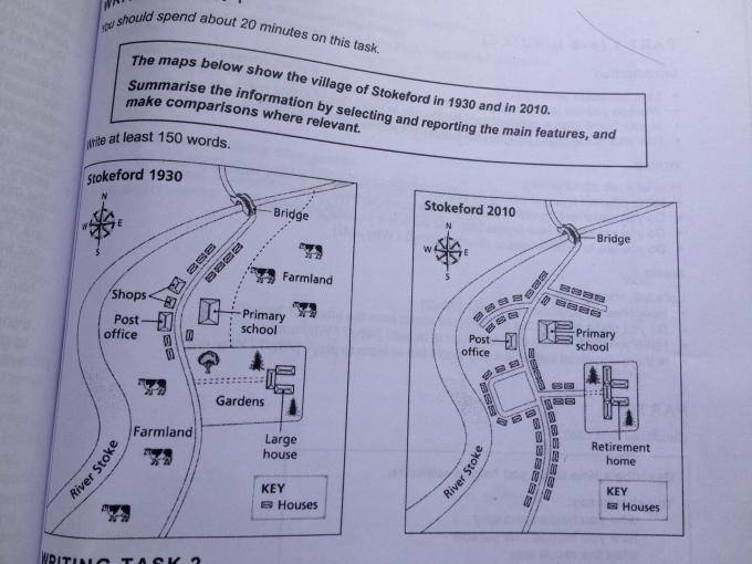
The both of maps display about alteration of the development in village in Stokeford over 70 year period. Overall, there are significant change with the several facilities that had been built in the village.
In the center of village, after the construction, the retirement home become the meeting point. Afterwards, the River Stroke passed through the village from south-west to north-east. Moving to the top side, the farmland dissapeared from all of the area. However, it was changed by many houses with the access of new road. Beside, the important side come from the primary school that was developed larger than before. In addition, the shops was replaced by houses and the motor way has been designed to connect between the center point and others facilities.
Turning to the bottom side, before the changed, the farmland was by far dominated next to the River Stroke. When it comes to 2010, it can be seen that there is a massive development in settlement sector. Moreover, there were no gardens area anymore close to the center point.

stokeford.jpg
