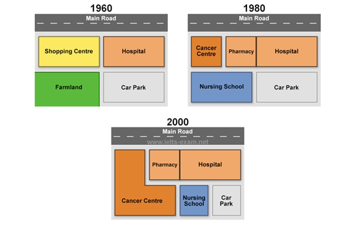
The alterations that have occurred in the construction of Queen Marry Hospital from 1960 to 2000, a four-decade period is illustrated in the map. Overall, it can be seen that the most noticeable changes are the replacement of business and green areas with several major health center projects.
To begin, there were several major changes in the west of map for healthcare purposes. Shopping center lying in the north west of the map was replaced by cancer center and pharmacy. While farmland area was substituted by nursing school. But nevertheless, the infrastructure was demolished and there was an extensive of cancer center in that area.
On the other hand, there were no significant alteration in the east of area. During the period, hospital and car park were still in the same place, but in 2000 the car park was minimized to half area, and the nursing school was building between cancer center and car park.

2.jpg
