development of the West Park school
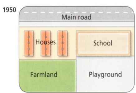
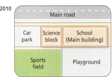
The two maps compare the alterations of West Park secondary school that happen between 1950 and 2010.
Overall, it is can be seen that there were many changes that took place at this school during this period. Some places are adapted to suit uses, some were knocked down to replace by new buildings.
Take a closer look, the variation occurred in farmland, this land became the Sports field with the unchanged area in 2010. There were three houses in the top left-hand corner of the campus in 1950, they were demolished in order to use the land for building a car park and science block. Like this, in 2010, two new buildings were created, the car park took up more than half of the land in the top left-hand corner. The science block was between the car park and school.
The playground was unchanged. School just became the main building in 2010.

75464409_42173988542.png
75464409_42173988542.png
