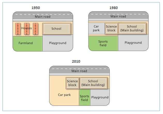
The diagram shows the changes that have taken place at West Park Secondary School since its contraction in 1950.
The map illustrates the changes which have developed in the west side of Secondary School in 1950, 1980 and 2010. Overall, it can be seen that in the school has occurred the expanding of infrastructure. However, houses and agricultural land was converted into a car parking area of school.
According to the map, from 1950 to 1980, there were two changes of school facilities. Houses which exist on the west side of the school have been changed into two parts, parking area in the west and science block in another land. Then, farmland which located next to playground has been converted into sports field.
There have also been changes between 1980 and 2010. The car park experienced a widening of the area, but the sport field and playground experienced a constriction. The sport field was changed into one third of playground area, and it was placed in the most western of playground area. On the other hand, the former of sport field area was used to extend the car park area.

cvsg.jpg
