Development of the Islip town
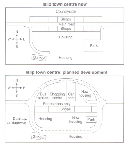
The maps below show the centre of a small town called Islip as it is now, and plans for its develop
The diagram demonstrates some proposed changes of the centre of a small town which named Islip.
Overall, several infrastructures will be constructed with the covering by round road. Otherwise, these developments will regard to shops and housing.
At present, the main road of the Islip centre run through from East to West but the second map shows that the main road will be transformed to route for pedestrians. Last but not least, the road will have some differences in structure, two-lane way will be considered in plan as well as its ring forming cover around the centre.
The shops which located at the north side of the road will no longer exist because of the appearances of bus station, shopping centre and a car park. New housing will be set up at two locations which are in the east of car park and to the west of the park. Education institution still unchangeable during the development.

6a0120a5bb05d8970c02.jpg
