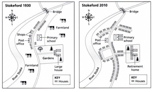
the village of Stokeford in 1930 and 2010
The diagram illustrates changes of Stokeford during the 80-year period.
Overall, the urbanization has taken place significantly in Stokehome, with the infrastructure re-planning and the massive wave of housing.
The main road, running along north-south axis, bisected the village into two parts. In the centre of the village, the removal of farmlands was replaced by the U-shape road, while the expansion of a cluster of houses along the new road. This tendency was undergone along the main road; two secondary roads have been expanded along with the increase of houses along two sides of these roads.
In the eastern, the opposite site of the new U-shape road, there was a land conversion from the garden and large house to the retirement home, with a small new road and a couple of houses connected to the main road. Sandwiched between these residential areas, the post office was remained; across the road, the primary school was spread eastward.

1.png
