Summerise the information by selecting and reporting the main features , and makes comparisons where relevant.
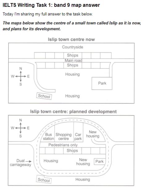
Given are maps which illustrates the plan change of Islip town and its current layout.
As can be seen from the maps , the countryside area will be replaced for amenities . The town will be dramatically changed and expanded to make way for sensible traffic systems.
Currently , this town has a main road running straightly from the West to the East , which is through the two ranges of shops . There are two branches lead to the South where the school and the Park are. Residential area totally converges to the South of the town and there is a countryside far in the North from the town center .
The most noticeable change will be the change in its traffic system into a circle area for pedestrians only , which will be covered by a dual carriageway . Therefore , the countryside and a row of shops in the North will have eliminated to make space for the bus station , shopping centre and car park area to the left . The school will remain unchanged outside the ring road , however, the Park is planned to be relocated at its current address. Beside some residential areas that have already existed , there will be space for a new one to the right of the car park and another on the left of the Park .

this is its illustration
