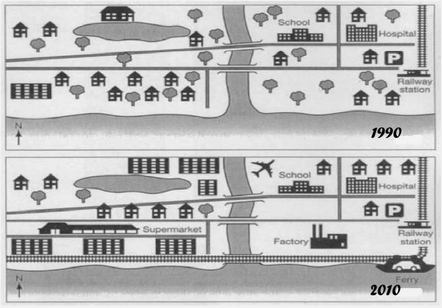
The map reveals the information regarding the alteration in Brandenburg in the course of two periods. Overall, there was a significant improvement with some facilities that had been built in this city.
Looking to the left side of river, in 1990, there were many houses and green areas in this city. Moreover, it could be seen that only one a big house and apartment existed in this area. However in 2010, the flats were by far predominated in the left hand corner and house areas had been removed. Furthermore, the supermarket was constructed near by apartments and the railway was built to connect the left and right city.
Turning to the right side, by 1990, the school and hospital had been built in this area and railway station was constructed as well. It could be seen that near by the station there were big green areas and several settlements that had been built. However, in 2010, the forest was cut-down and replaced by a labor building, while other buildings remained unchanged.

Map_graph_3_Bulan_K.jpg
