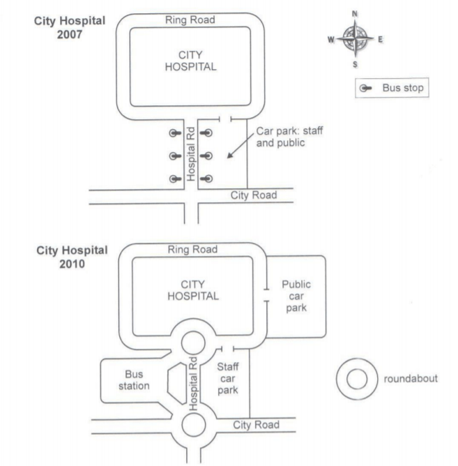
The two maps below show road access to a city hospital in 2007 and in 2010.
The given maps illustrate the modifications that were made to a city hospital's transport infrastructure in the 2007-2010 period.
Overall, it is apparent that there were some significant differences between the two layouts. These involved the intersection upgrade and the construction of bus and parking facilities.
The most striking change was the appearance of the two new roundabouts. While the first one was erected at the three-way junction of Ring Road and Hospital Road, the other one was built at the southern end of Hospital Road. The main hospital building, which was encircled by Ring Road, remained unaltered throughout the period.
Bus system and parking spaces also underwent some radical changes. In 2007, there were 3 bus stops on either side of Hospital Road. Three years later, these were obliterated to make way for a large bus station connected with the roundabouts. The parking area, which was once accessed by both the members of public and the staff, was later on separated as an exclusive public car park was added to the east side of Ring Road.

map.png
