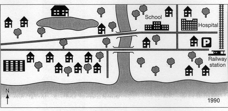
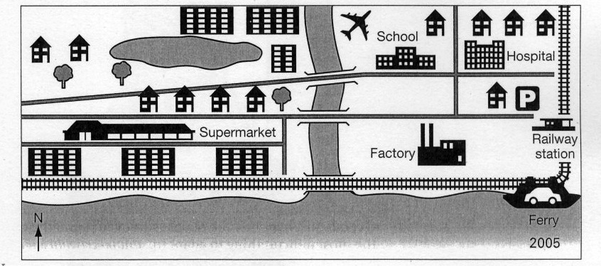
The maps illustrate marked changes which have taken place at the coastal resort of Templeton from 1990 to 2005.
In 1990, the settlement was a much greener residential area with a large number of trees and individual houses, but during the next 15-year period the area witnessed a number of rapid changes. The most noticeable is that all of the trees south-west of the river were cut down, with all the houses being knocked down and replaced by supermarkets and a new stretch of railway from the river running directly west. Moreover, a new ferry was also constructed next to the railway line.
In the south of the river, all of the trees were chopped down to build the factory. Further developments were the construction of an airport near the north-east corner of the river. Only a few trees north of the river were remained and made way for the houses and apartments. Besides, new houses in the center of the town were built near the streets.
Overall, a comparison of the two maps reveals a change from a largely rural to a mainly urban landscapes.

page45image256.jpg
page45image256_2.jpg
