Islip town centre
The maps below show the centre of a small town called Islip as it is now, and plans for the its development. Summarise the information by selecting and reporting the main features, and make comparisons where relevant.
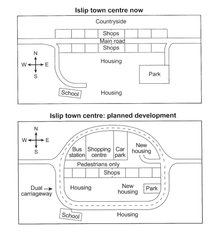
The given maps depict two versions of Islip town centre: the one in the mean times and the one which is planned for its development. Overall, it is clear to see the most noticeable change will be the new construction of a dual carriageway around the town centre, in replace of the one way road.
To be more detailed, the shops on the north side of the main road will be replaced by various new areas: bus station, shopping centre, car pack and new housing, while the shops on the other sides will be kept. Next, the main road will be changed into the pedestrians-only road in the middle of the town centre. The park area will be minimised in the planned development.
Besides changes, the school is seen to be kept in the plans for development, with a little extended area. Housing in the southern part of the town centre will be kept, with an addition of new housing nearby the park.
Thank you very much for spending time reviewing my essay!

31102020.PNG
