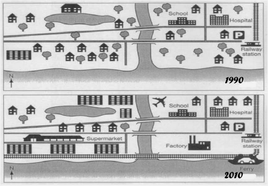
The map reveals the information about the development in Brandenburg in the course of two decades started in 1990. Overall, it was essential to bear in mind that there were additional apartment and supermarket located in the west of the river, while the factory and airport were built in the east of the river.in addition, the construction of railway appeared to be true alongside the coast.
As we can see that, the threes in the east of the river were cutting down and transform into the airport located near by the school, whereas factory in front of the sea. There is no more three in the alongside the sea. After that, two houses in front of parking had been relocated in the behind of the hospital. Furthermore, there is an extra railway through the length of the beach.
Turning to the west of the river, houses and trees are knock-down to add apartment alongside the railway and supermarket as well. Then, two commercial buildings had been built near by lake which cutting down the trees. There were additional residential areas located behind the supermarket.

map_3.jpg
