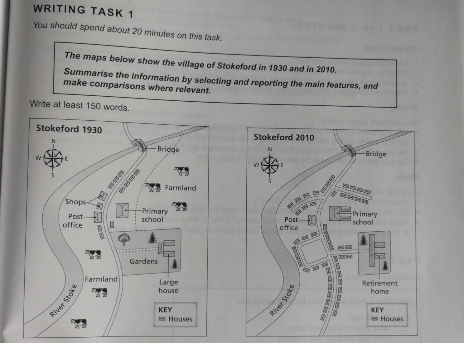
The given two maps show how the village of Stokeford changed during a period from 1930 to 2020. Overall, the village experienced a reduction in the size of farmland area as well as a significant increase in the number of new houses after almost a century.
In 1930, the village consisted mostly of farmland with a shop, a primary school, a post office and a few houses. Moreover, there was a large house built on the gardens located to the east of Stokeford.
By 2010, the village changed considerably by the total disappearance of farmland and a soaring number of new houses built along the main road. The main road running through the town was expanded into many routes and the primary school was also enlarged. The size of the gardens was narrowed and the former large house was turned into a retirement home. The only things that remained the same were the post office and the bridge crossing the River Stoke.

335387_1_o.jpg
