Houses and Residential Buildings
The Map below shows the changes in an American town between 1994 and 2010. Summarise the information by selecting and reporting the main features and making comparisons where relevant.
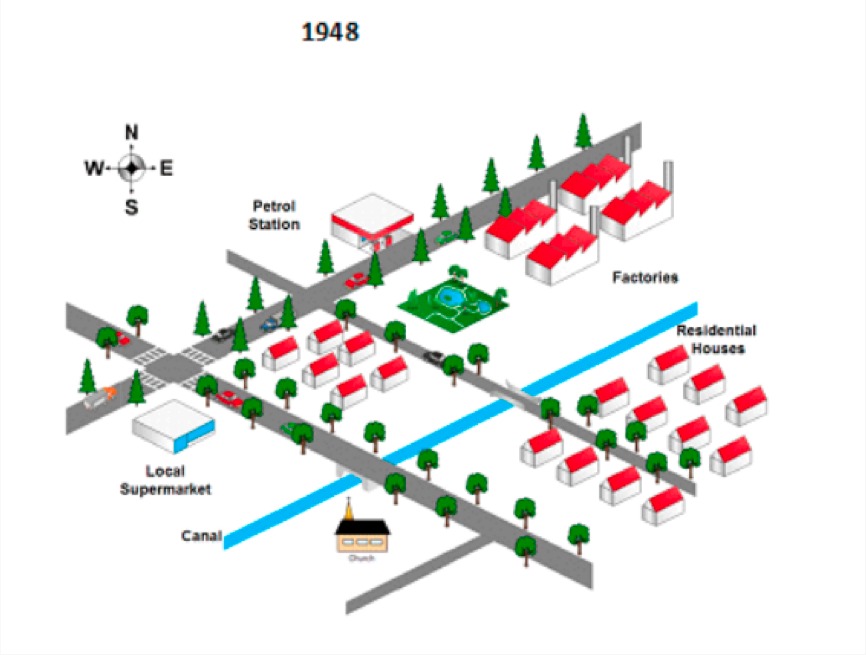
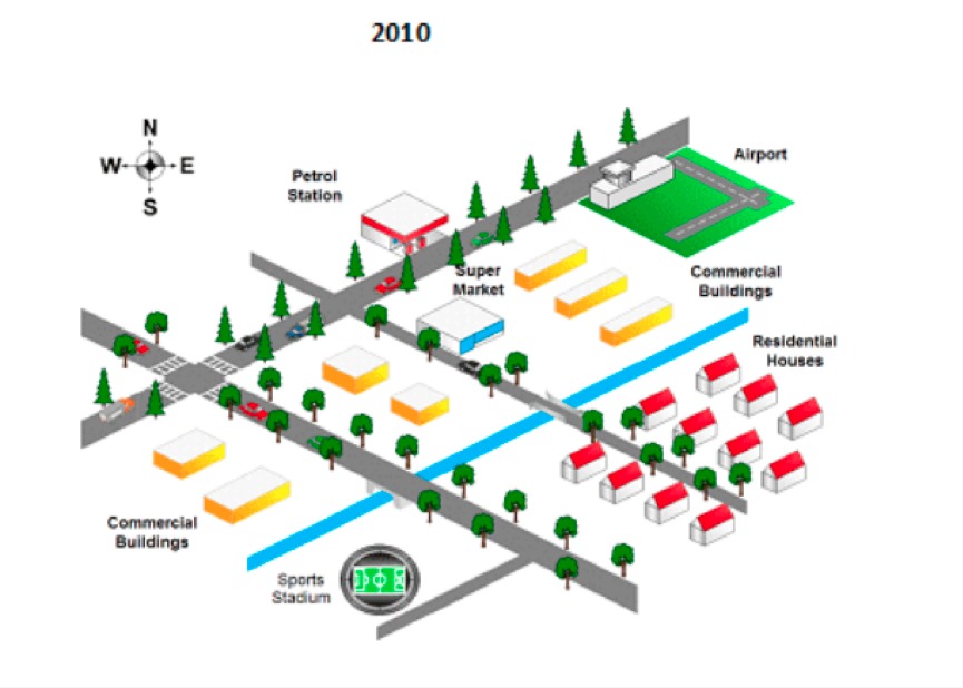
The maps illustrate about the alteration of some buildings is in an American village between 1948 and 2010. It can be seen that north west and south east of town had experienced alteration some construction significantly in the couple of years.
To begin, north west side of canal in 1948 had few features such as factories, petrol station, residential houses and local supermarket from the north side to the south side. Petrol station was the only feature which existed in both of the years. Factories in 1948 had been altered into airport in 2010. Opposite of the gas station in 1948 was garden albeit it changed into commercial building and supermarket. In 2010, commercial building also existed in cross road, but before that in 1948 houses and local supermarket still existed.
On the other hand, the features in south east side were only two buildings such as residential houses and church in 1948. However, church was altered into sport stadium over six-decade. In addition, residential houses did not experience alteration in the couple of the year.

17495604_10207394714.jpg
17577781_10207394714.jpg
