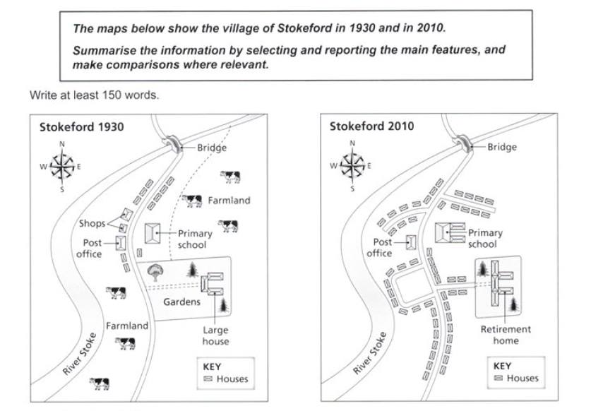
The maps show the village of Stokeford in 1930 and in 2010.
The maps illustrate the changes in the village of Stokeford in 1930 and 2010. Overall, it can be seen that over eight-decade there were several changes in agricultural lands and buildings, but some buildings did not show any change. The village had become more crowded by residents in 2010.
First, the biggest change in this village during eighty-year period was the loss of farmland. There was a river Stoke which flows from northeast to southwest of the village, and the main road was in the middle. The farmland in southwest and the northeast of main road was replaced by houses and new branch roads. The shops which located next to the post office were demolished.
Other than that, there were developments of some buildings which had existed in eight decades ago. The large house had become larger and it was converted as a retirement home. The primary school was also undergoing renovation and expansion. Even though, post office and bridge had not changed over the period.

new.jpg
