Two Shops
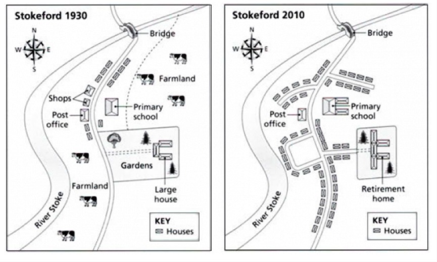
The map illustrates regarding to altering the Stoke village in 1930 and 2010. It can be seen that both in the western and eastern of the village had changed.
In the past, 1930, the western land between the River Stoke and a long side road had dominated by Farmland and two shops. By the time, in 2010, not only a long side farmland but also two shops had removed due to erect housing. Furthermore, it is clear that expanding some little road has constructed also.
On the other hand, instead of at opposite the road, there are three changes in eastern side of the road in 2010. Firstly, similar to western side, farmland which located behind the primary school had constructed into houses and expanded on the road. Secondly, the primary school had expanded on three buildings. Lastly, the large house that was located in behind garden had turned into retirement house.

WhatsApp_Image_2017.jpeg
