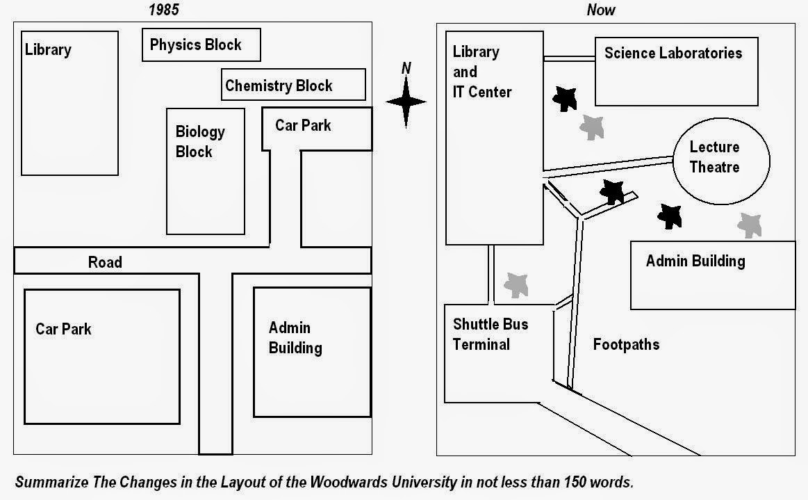
The maps show the changed of Woodwards University spatial during 1985 until now. Overall, it can be seen that the university has altered most of the layout at present, demolished some establishments and replaced them with some others regarding to the necessity, much different from 1985's.
On the north west, there was a library and IT center which has been moderate expanded to the south compared to the old one. Follow the footpath, they built Science Laboratories and Lecture Theater on the north east. In contrast, on the 1985's map showed, there were physics block and chemistry block following the biology block and small car park at the same position.
However, on the south west, the bigger car park had been changed into shuttle bus terminal, which used less space than car park. On the south east, admin building was reconstructed a slightly above the past, it reduced in the length but expanded in the width. That position left a lot of open space in front of it. The road had gone, it has been changed into footpaths, which designed directed to buildings.

Woodwards_University.jpg
