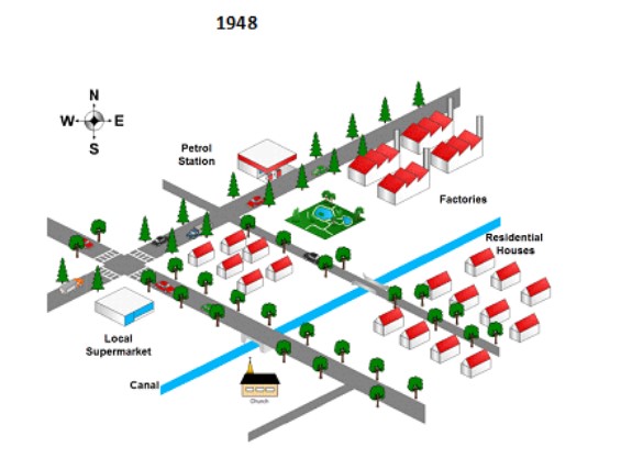
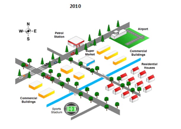
The map below shows the changes in an American town between 1994 and 2010.
The given maps illustrate the alteration of America's Town for a 62-year period beginning in 1948 and ending in 2010. Overall, it can be seen that for over sixty-two years, several business sector and facilities had been built in the town.
Looking at the details, various changes was altered in the north-east areas from 1948 to 2010. The blocks of factories had been demolished and replaced by airport and some commercial buildings. On the left of this commercial buildings, a supermarket had been built replacing the lake which was surrounded by trees. Across the lake street, some settlements had been reconstructed as commercial property. It also happened to a local supermarket which was converted to advertisement buildings.
Moving to the bottom right-hand side of the canal, the church which can be seen in 1948, flattened and substituted by sport stadium. By contrast, the residential landscape in the south-east of the town and the petrol station in northern of the town remained unchanged.

MAP_02.jpg
MAP_03.jpg
