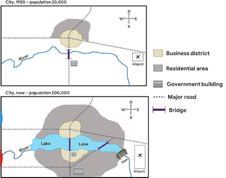
City now and in the past on the map
The given layout delineates the disparities of a city between the year of 1950 and the present day.
The initial impression from the map is that along with the expansion of population, economic, private and public sectors have grown in size and number. Additionally, the city has undergone virtually no reposition of the abovementioned.
Before the revamps, in the northern part of the city, the residential area was home to 20000 citizens. It covered the business district, only where the two main roads intersected. Whilst one of them led to the airport on the right-hand side of the city, the other commenced from the north, which passed a bridge prior to reaching the government building.
After several modifications, the residential area has been extended to all four directions to meet a ten-fold increase in population 's demands. It circles the economic zone, which has also been widened. Both are divided into halves with the erection of a new lake. Furthermore, there has been the emergence of a newly-built road, headed from the west to join the eastern one after crossing a bridge. Meanwhile, the airport has remained intact in terms of location; nevertheless; has stretched to the south of the city.

OperaSnapshot_2021.png
