Hello, can you help me the estimate score of my writing, give me the detail error and the correction in my essay? Thank you.
IELTS Writing Task 1:
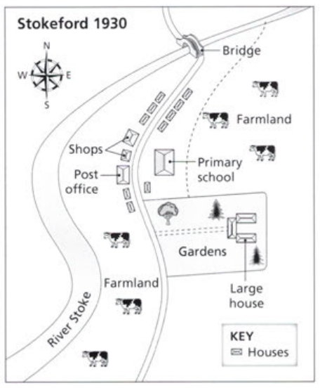
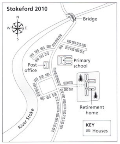
The map below show the village of Stokeford in 1930 and in 2010.
Summarize the information by selecting and reporting the main features, and make comparisons where relevant.
-----------------------------------------
The stipulated diagram depicts the major development of the village beside the River Stoke during eight decades from 1930 to 2010.
Overall, the layout witnessed radical changes, with the most noticeable being a rapid increase in housing density.
According to the pictorials, the small town was located to the east of the river in 1930 and still maintained the original features until 2010. There was a roadway connected to the Bridge on the northernmost side of the small town in both maps. Along the left side, two shops formed in 1930 had disappeared to make way for a frontage street and accommodations by 2010. Besides that, the local primary school opposite the Post Office had some extensions, while its position remained the same in the later year.
The outstanding point on the map is the disappearance of two large spaces of farmland. The part of the land for farming along the riverside before is substituted for settlements. A garden was placed in the center of the village with several trees and residential areas in 1930, but by 2010, one of the trees had been cut down and a retirement home appeared.
-----------------------------------------

The layout of the village in 1930
The layout of the village in 2010
