The following is my report, please give me some feedback, thank you very much!!!
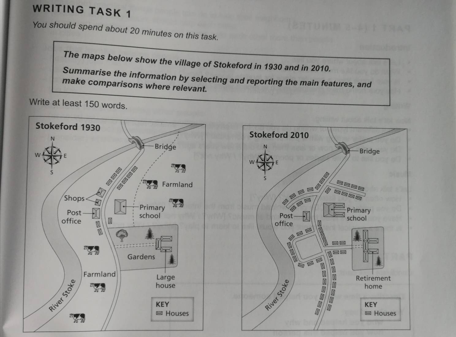
It is clear that compare with the map in 1930, the village Stokeford village in 2010 had more houses. In addition, the layout of the road became more complex. The utilize of the land also had been modified. Also, there were some different on the size of primary school.
In 2010, the shops were located in the north of the village were replaced by the fork road, and the other fork road was diagonally across from it. Both of them were surrounded by the houses. For the gardens and large house in the east of the village, the garden disappeared and the large house expanded to a retirement home. A new road linked the retirement home and new houses area to the main road.
The farmland disappeared in 2010. The primary school only had one building initially, but it had three buildings in total when time went on 2010. Besides these changes, the post office in the centre and the bridge in the north were still remained.
These two maps illustrate some changes in the Stokeford village which took placed in 1930 and 2010.
It is clear that compare with the map in 1930, the village Stokeford village in 2010 had more houses. In addition, the layout of the road became more complex. The utilize of the land also had been modified. Also, there were some different on the size of primary school.
In 2010, the shops were located in the north of the village were replaced by the fork road, and the other fork road was diagonally across from it. Both of them were surrounded by the houses. For the gardens and large house in the east of the village, the garden disappeared and the large house expanded to a retirement home. A new road linked the retirement home and new houses area to the main road.
The farmland disappeared in 2010. The primary school only had one building initially, but it had three buildings in total when time went on 2010. Besides these changes, the post office in the centre and the bridge in the north were still remained.

topic
