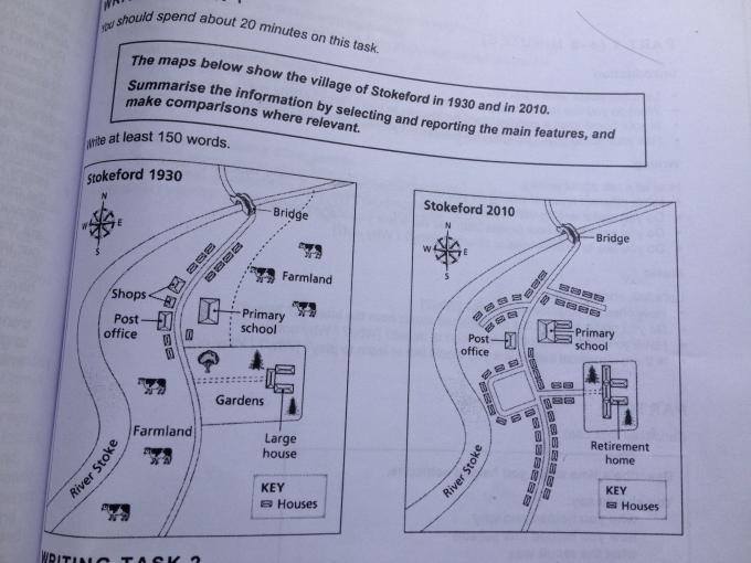
The two maps present the development of the district site in Skoteford, a period of 80 years, started in 1930. Looking at details, before being established, the area was certainly farmland and several shops there.
To begin, between 1930 and 2010 there are several alteration in the course of 80 years. Farm animals and shops were easily seen in former year but it was demolished in the years later. Surprisingly, in the latter year, modern settlement was developed in this area, running alongside a main road. In any case, the yard and large house was replaced by the private house and retirement home respectively.
In a stark contrast this, the primary school was expanded with bigger area, located in eastern of post office.The government build motorway junction in the north, between road in front of elementary school and bridge. Afterwards, retirement home was bigger with paving highway linked in the main street.

15134303_15983485368.png
